Walk London's Roman wall: a lockdown day out
Looking for something to do in lockdown? Much of the wall of Roman Londinium is still visible above ground, and you can walk it in a couple of hours
I explore the weird and wonderful in the English landscape and write about it every couple of weeks. If this sounds like something that would interest you, why not subscribe? Or, if you’re already subscribed, consider recommending to a friend to whom it might also bring joy?
We moved back to London two weeks ago. It only took a week of crawling up the same four walls and receiving about eight million Amazon deliveries a day before the urge for going once again struck. But where? Somehow I got the idea in my head to visit the London Wall. It must have been the name of the street that I noticed the first time last summer, walking to a podiatrist appointment. And then some judicious Wikipedia-ing, and the fact that all other more scintillating Sunday activities are banned, and well, now, here we are.
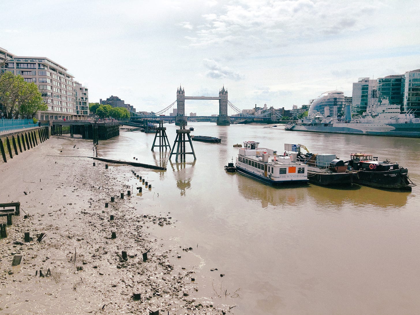
The Thames from part of what would have been the Roman waterfront.
I’ve always been fascinated by the idea of previous Londons beneath the one on which we now stand. Its idiosyncratic place names and blue plaques, such as the incongruous one outside my old office on Old St roundabout in memory of the City Road turnpike. I remember watching a video in the Museum of London as a child, a time lapse from when it was just river and trees and grass, the layers building up over time: the timbered bridges and barges, the traders and invading armies.
The City is surreal now. Everywhere is dead closed, filled only with cyclists whipping by on their now-empty lanes. Since Roman times, there’s barely been a time when London wasn’t a bustling city. At its height, around the year 122, its forum was one of the highest buildings in the Roman Empire north of the Alps. Tacitus wrote that it was a centre of trade: archaeologists have uncovered goods imported from across the Empire. Suburbs expanded outside the city walls. Southwark in particular seems to have been a settling place for people from all parts of the Empire: A 2017 study of 22 people found buried in Lant Street showed that four of them were likely of African descent, whilst two had Asian ancestry. Five of the skeletons indicated they were from the Mediterranean. Roman London was unprecedented in its diversity and people may have come here for many different reasons: in the military, as slaves, or for trade.
The wall itself originated in the late 2nd or early 3rd century, growing out from the original fort at Cripplegate. Under almost constant construction and reconstruction, it was one of the last major building projects before the Romans left in 410AD. Continually fortified throughout Anglo-Saxon and mediaeval times, work to demolish the walls continued into the 19th century, but some sections were incorporated into existing buildings. Others were destroyed — or revealed — by the Blitz.
I was blown away by how many impressive sections of wall — much of it the Roman original — are still visible above ground. It’s incredible I managed to be in London for so long without noticing. You can follow the route here on OS Maps —I’ve marked all the parts of the wall, even those that aren’t visible, but the description below takes you through the highlights. The underlined headings contain links to the relevant entry on the Historic England website. It’s not a long walk — around 6km — but make sure you bring comfy shoes (for the tarmac!) and leave enough time to explore the monuments fully.
Start at Tower Hill tube station. Just around the corner, in view of the Tower, is an impressive section of wall with a statue believed to be of the Roman Emperor Trajan. Roman work survives up to the sentry walk, 4.4m high, with the above part being mediaeval. This part of the wall also contained a tomb inscription for Julius Classicianus, the Roman financial administrator here in AD61. To the west is the site of Tower Hill, the notorious execution site for prisoners, last used in 1747.

Tower Hill section of London Wall, with the Norman Tower of London visible in the background.
Don’t miss the second section of the wall here: walk around the front of the Citizen M hotel and a little way up Cooper’s Row. Entering via the car park of the Leonardo London City Hotel, you will reach a courtyard where you can see an imposing continuation of the wall, running through the buildings’ foundations. As before, here Roman work survives up to 4.4m, with the upper section being mediaeval with clearly visible archers’ loopholes and fragments of access staircase.
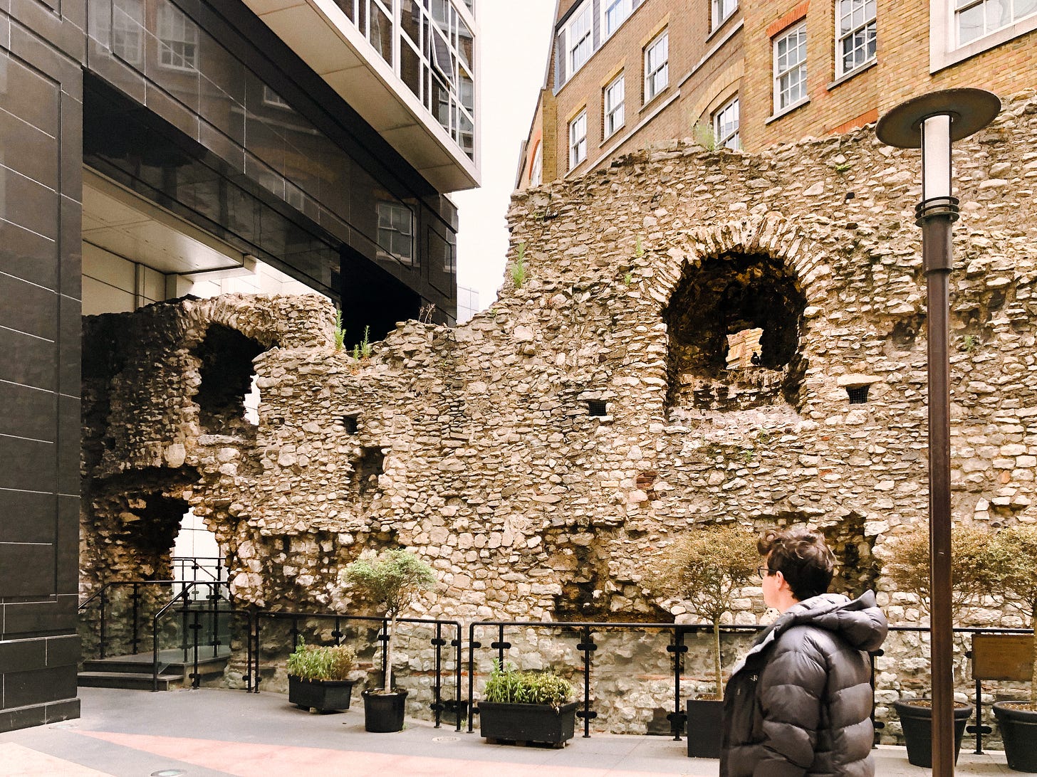
Section of wall in the courtyard of the Leonardo London City Hotel, with mediaeval archers’ loopholes
Crutched Friars: Friar statue
From here, walk through the door in the London wall and out the other side. Turn left under the railway arches. Continue up Vine Street. You are following the old line of the wall here, but it’s beneath ground and buildings. At the intersection with Jewry street, turn left and walk a little further down the street, to the former site of Crutched Friars, a mediaeval monastic order. Their presence is marked by a statue of two friars facing each other on a corner.
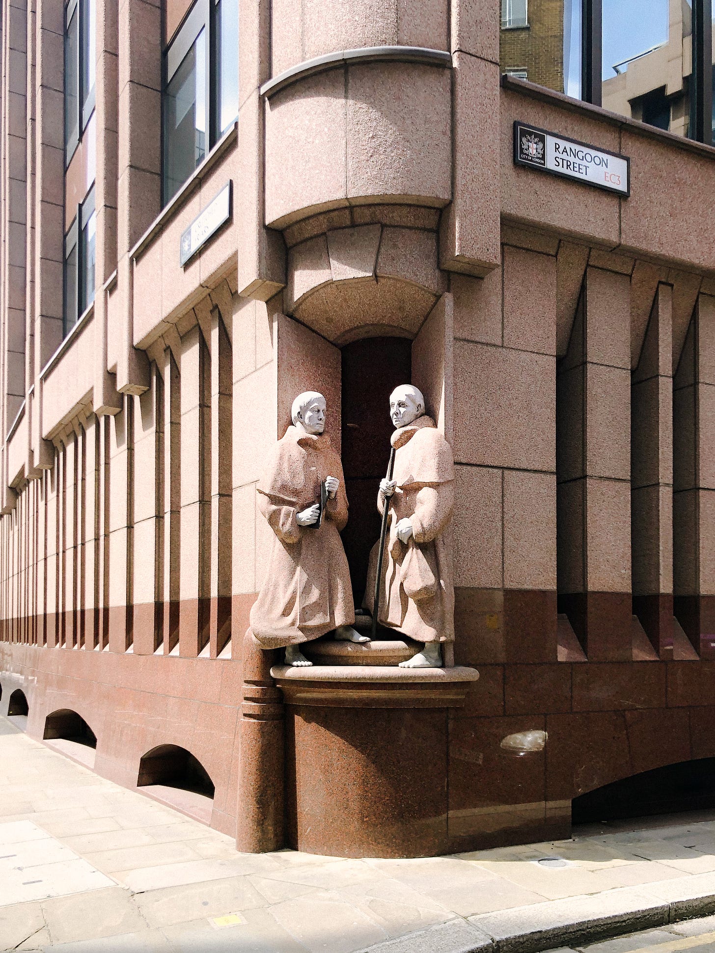
The friars, with their crutches, on Jewry Street.
Aldgate and Houndsditch
Turn back on yourself to head north on Jewry Street, to where it meets Aldgate. Almost all of the mediaeval City of London was destroyed in the great fire of 1666. However the gates of the London Wall — Newgate, Aldersgate, Cripplegate, Moorgate, Bishopsgate, Aldgate, Tower Hill postern — were only demolished in the 1760s. Their traces remain today at the places where the modern road network enters the city. Aldgate gave passage to the Roman road to Essex and East Anglia. Here, as in many cases, you can still see a narrowing of the street where the gate would have been.
Continue up Bevis Marks, still following the underground line of the wall. The adjacent street is called Houndsditch, so named because outside London Wall was also a defensive ditch, which in mediaeval times served as a dumping ground for dead dogs, among other rubbish. Here, it is obvious that the line of the wall still exerts its influence: the Gherkin lies within Houndsditch whilst one street away, outside the old wall, everything is different.
Crossing Bishopsgate, continue onto Wormwood Street, so named because of the wormwood plant that used to grow on the wall. This street becomes the aptly named London Wall. Continue till you reach All Hallows church on your right; around the front of the church, a blackened section of London wall bounds the churchyard. Once again, the lower parts are Roman, the upper parts later.

Section of wall bounding All Hallows Churchyard.
Continue past Finsbury Circus and reach Moorgate, site of what was once a small postern in the wall, leading onto a marshy area possibly flooded by the river Walbrook. Continuing past a modern development on your right, you will reach a garden with an evocative mediaeval ruin. This is the remains of St Alphage church, built in the 11th or 12th century and dismantled during the Dissolution of the Monasteries.

The remains of St Alphage church, dating from the 12th or 13th centuries.
More impressive, however, is the imposing section of wall outside the Salters’ hall a few metres away. Plunging down into a beautiful modern garden, as it would have done into the original ditch, this section of wall was revealed during the Blitz.
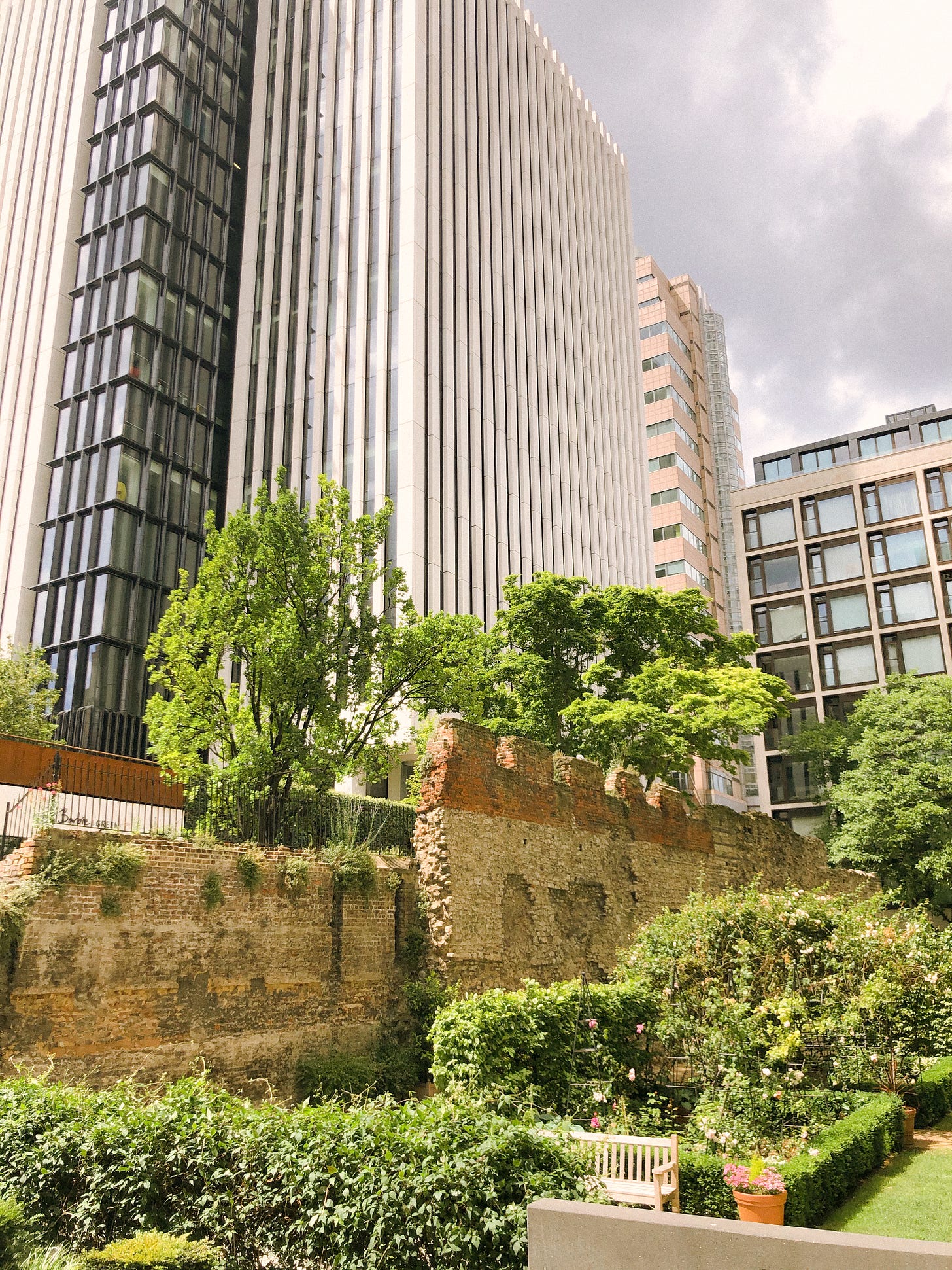
Section of the wall bounding the garden of Salters’ Hall.
It is also the only section of wall with distinctive patterned brickwork crenellations added in 1477 during the Wars of the Roses.
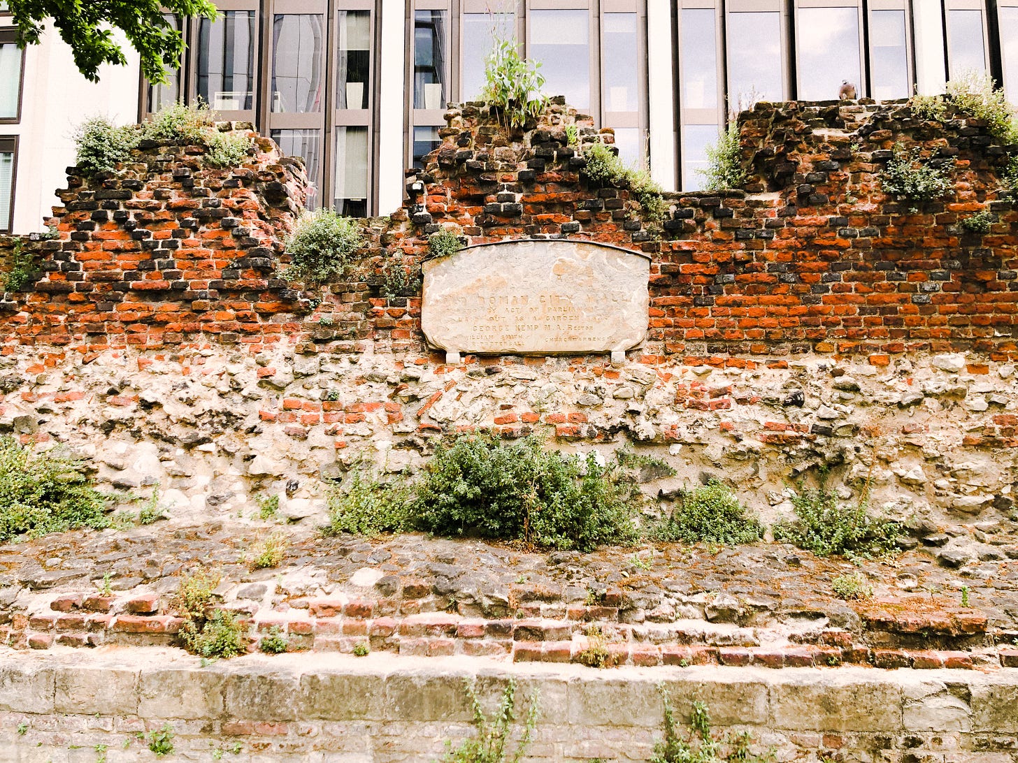
Wall showing patterned crenellations added for defensive purposes during the Wars of the Roses.
Barbican: next to St Giles church
Cross the green area with the Salter’s Hall on your left to reach the street named St Alphage Garden. Walk to the end which will bring you to the entrance of the Barbican estate. When you go in, turn left to walk past St Giles Church. You will see the surviving section of Barbican wall before you, including a flooded ditch and a mediaeval bastion at the end.

Section inside the Barbican, with 13th century bastion at the end.
Exiting the Barbican the way you came, turn right down Wood Street to again meet London Wall. Continue a little way until you reach the entrance to a car park; you will see a section of the wall and mediaeval bastion looming behind. You can follow this ivy-covered wall — the corner of the original Roman fort at Cripplegate — to the corner with the tower you saw a moment ago from the other side.
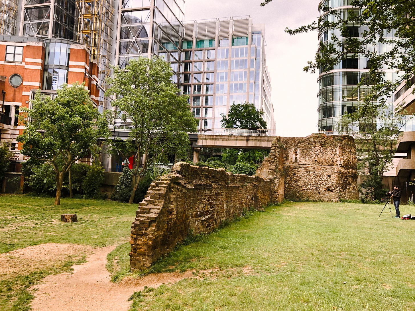
A mediaeval bastion added to a corner of the former Roman Cripplegate fort.
Doubling back on yourself, now cross London Wall onto Noble Street, where an impressive section of the wall is revealed below a walkway.

Wall visible at Noble Street.
A brief detour to see the site where Aldersgate, the gate leading to Clerkenwell and Islington, once stood. Turn right onto Gresham Street and then right again onto Aldersgate. Continue up the street a little way until you are opposite the church; here is a small plaque marking the site of the former gate. You can also take a small detour to Postman’s Park on the opposite side of the road, alongside the church; the wall is beneath the ground here, but the main attraction is the sentimental wall of plaques in memory of those who died to save others.
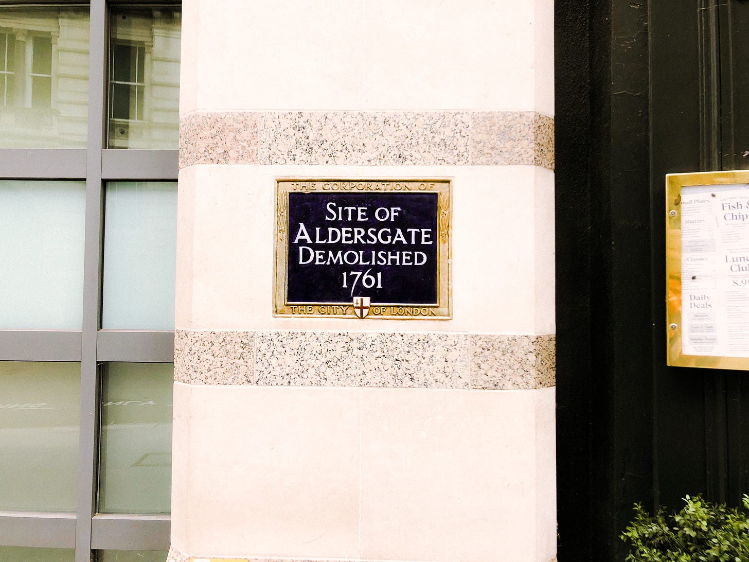
Plaque marking former site of Aldersgate.
Turn and head back along Gresham street into the City. Continue until you reach the Guildhall, on the corner with Aldermanbury. In happier times, you would be able to go into the museum to see the Roman amphitheatre, remains of which now lie underground. Now, you must content yourself with the outline: the giant ellipse traced on the courtyard paving.
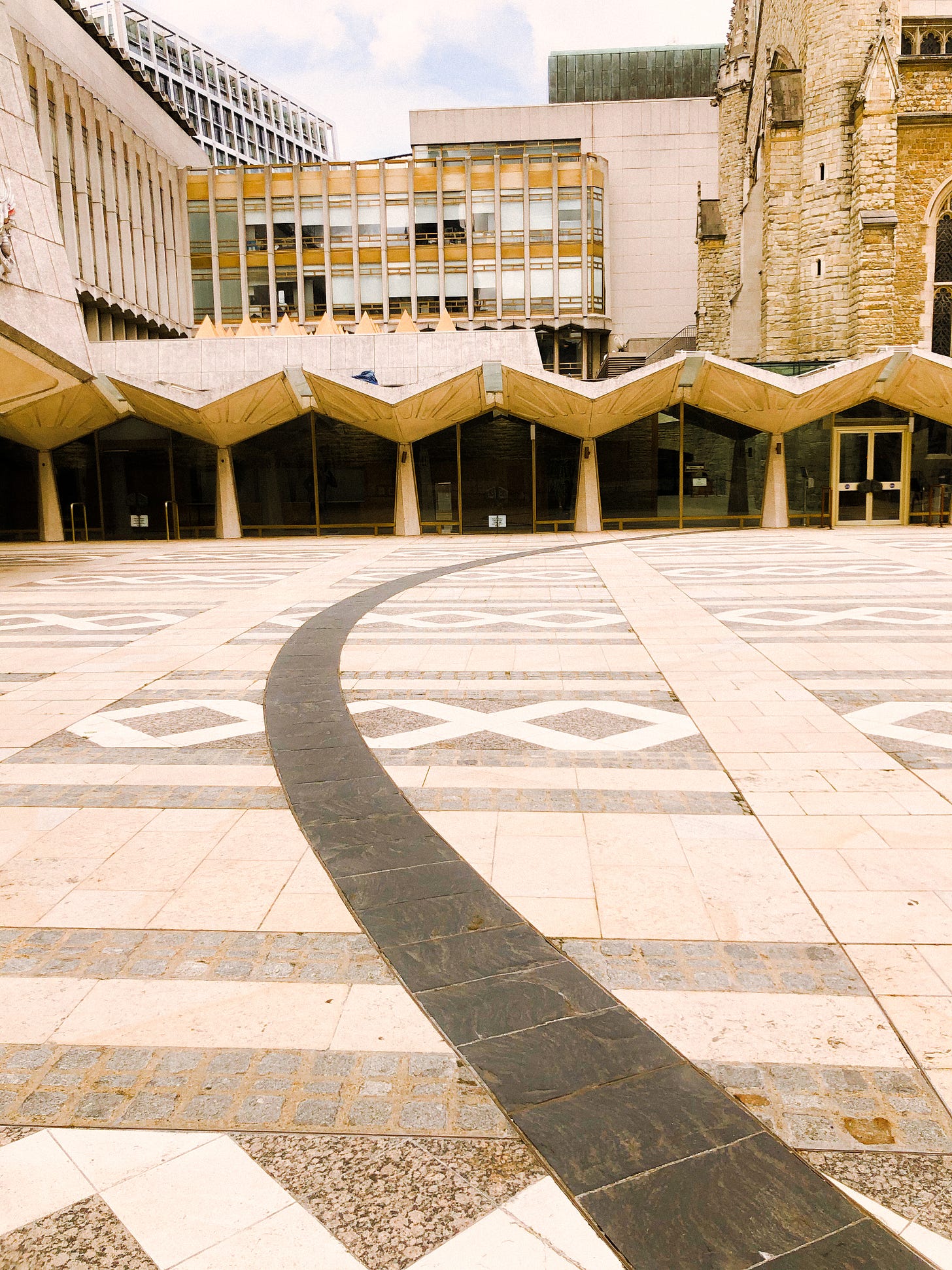
Outline of Roman amphitheatre lying beneath Guildhall yard.
Turn onto King Street and continue south until you reach Upper Thames Street (the big main road by the river). Cross the road and turn right. On your left you will come to a small slipway called Queenhithe; at the end of this is a dock that has been in almost continual use since Roman times. The Thames laps away at the mud, which no doubt still contains many historical secrets.

And now, you’re finished! Well done, time for a well deserved cup of tea.
I’d love to hear your ideas for other historical walks or places to explore around London — big or small. Is there something in your neighbourhood that deserves more attention, perhaps?
Please send me your comments, thoughts, feedback and recommendations! You can comment directly on this post, or reach me on Twitter or Instagram: I’d love to hear from you.
If you enjoyed reading, please consider subscribing, or sharing this newsletter with a friend.
Sincerely,
Ruth


